
Aerially surveyed by helicopter. Site survey and water sample collection in flood-attacking areas.
- Survey member:
- Honda, Furumai, Katayama, Masago, Chaminda, Tobino, researchers from Kasetsart University
 In the morning, conducted aerial survey by helicopter starting from Bangkok through Nonthaburi and
Pathum Thani Province and ending at Ayutthaya Province for 90 minutes to keep track of the wide view
overlooked from the sky.
(The video is available at the link of the aerial images on the upper right corner)
After that, surveyed the main roads surrounding Kasetsart University and Don Mueang Airport in
Bangkok and collected the flood water samples at 3 points.

The survey sites and water quality information (Coliforms, ammonia concentration: indicators for fecal
contamination) can be viewed on above map.
※When clicking a marker on a survey site, the pictures of the survey site can be visualized. If an item of water quality appeared in the list box at the bottom left of the map is selected, then click at “Show” button, the page will jump to water quality information at the selected site. And when clicking a symbol inside the map in the water quality information page, the results of water quality analysis at the site will be shown.
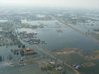
(Overlook from helicopter)
From the sky, there were the flooded areas in places in Bangkok. But, floodwaters have been gradually reducing. Floodwaters in the ancient ruins of Ayutthaya Province have almost dried up. But floodwaters in many places in Nonthaburi and Pathum Thani areas were still remained.
(Site survey)
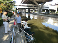
In front of Don Mueang Airport, the roads were still filled with flood water. Flood drain was attempted with pumps. Water samples were collected at 2 points in a main (Point A, Point B) and in a canal near Kasetsart University (Point C). All of these locations were filled with water during the first survey 2 weeks ago. However, on 4 December 2012, Point A and Point C were dried off. Therefore, water samples were collected from the neighboring canals.
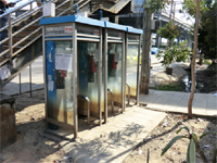
Traces of the flood near Bang Khen Station
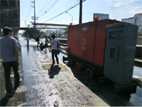
Flood drain by pumps near Don Mueang Airport
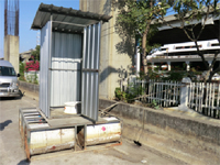
A floating toilet on a road
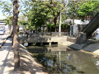
Point A
Point B
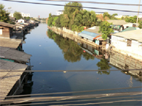
Point C